SPEND LESS TIME
MANAGING AND MORE
TIME MARKING.
GUARANTEED.
Blue Stakes of Utah Ticket Management Software for Municipalities and Utilities
No credit card required.

Your time is precious. The work you do is important. The last thing you need to do is waste time running back and forth to the office clearing tickets.
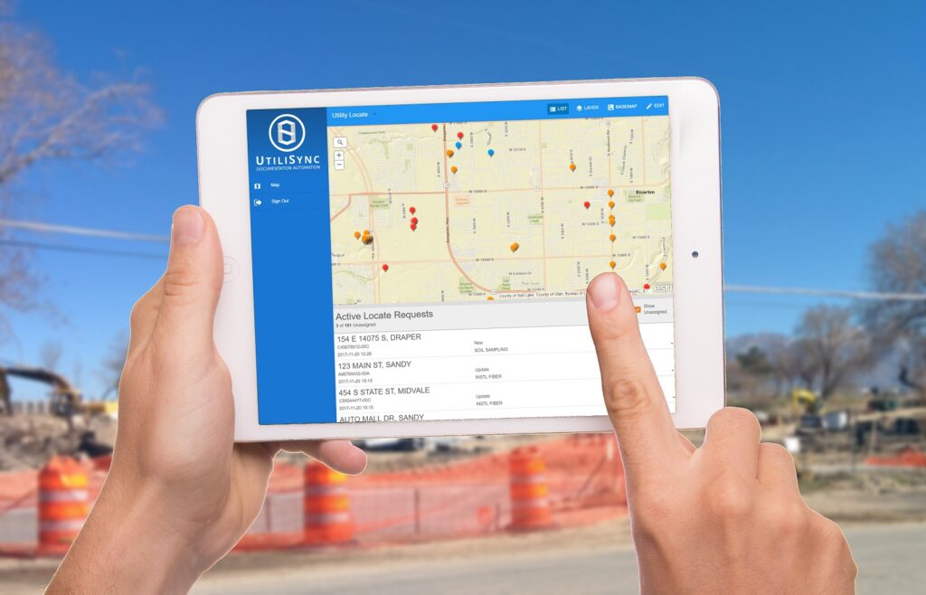
UtiliSync is a fully configurable GIS-based ticket management software for
municipalities and utilities that enables its users to electronically receive ticket requests, choose a ticket resolution and automatically inform the requestor when the ticket is closed. Once completed, a Positive Response will automatically be sent to Blue Stakes of Utah
Why Utilisync ?
Better Time Management
Spend less time managing your utility locate requests and more time getting your work done!
Clear Communication
Everyone from the Public Works Director to the utility manager and utility marker can see the active tickets and who they are assigned to.
Stay in Compliance
Automatically notify excavators of the ticket resolution.
How it Works
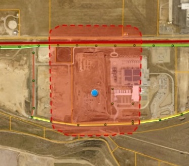
UtiliSync automatically receives new utility locate request tickets and plots
them on a map in real-time.
Step 1
Set Up Your Account
It only takes 2 minutes to set up UtiliSync. We will provide you with an email to send to Blue Stakes of Utah instructing them on how to configure a new receiver. You can even ask them to add a “test” receiver so you can keep receiving tickets while you try out UtiliSync.
Step 2
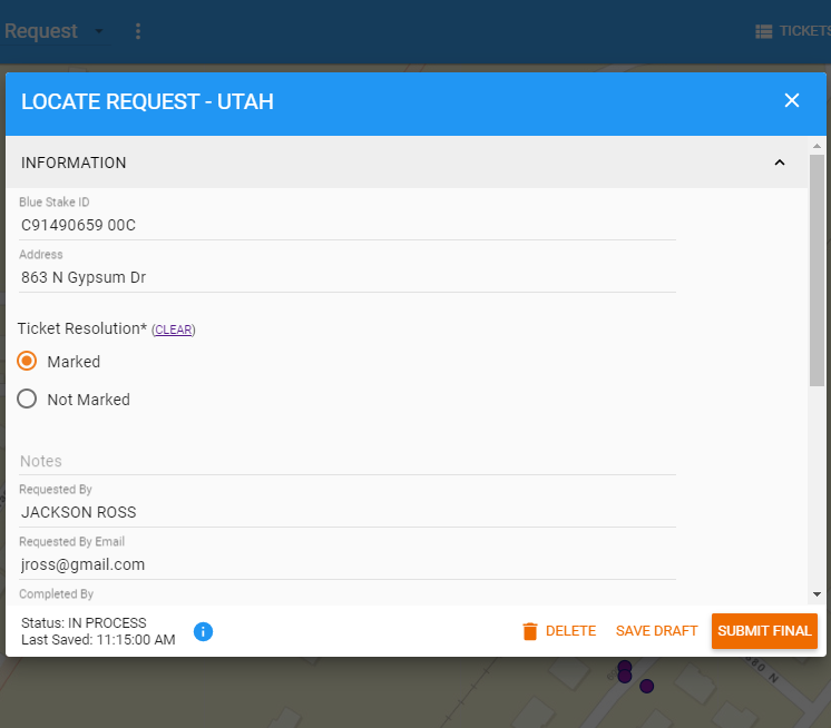
Complete Form
All open tickets are listed by due date and shown on a map. Simply choose a ticket and complete a form. You can also attach photos and add an electronic signature. Once the form is completed, a PDF documenting the ticket resolution is generated.

Step 3
Send Positive Response
A Positive Response is automatically sent to Blue Stakes of Utah every time a ticket is closed, including photos and sketches. No more manually looking up and closing tickets when you get back to the office. It’s all done in the field.
Features
GIS-Based
View your GIS data (ArcGIS Server and/or ArcGIS Online) overlaid with the ticket location area making it easy for you to determine if you need to mark the ticket.
Real-Time Ticket Mapping
Don’t waste time driving to the edge of your service area only to find you need to return the next day. View the tickets on the map as they are received allowing you to make better decisions on where to focus your efforts.
History of Tickets
Easily view all tickets complete for a given area. This will save you time instead of trying to look up ticket numbers, you can simply search the area of interest.
Configurable
From the color of the points on the map, to the forms you complete and the emails that get sent out, UtiliSync is customizable and configurable. UtiliSync matches your workflow and preferences, making it intuitive to use.
Attach Photos
There is no better way to document your work than by taking a photo. UtiliSync makes it easy to attach multiple photos to a ticket, helping you put the documentation in place should a dispute ever arise.
Assign Tickets
No more confusion about who is responding to what. Simply assign a user and everyone knows what they need to do.
Fast Web App
No need to sit down at a computer. Everything in UtiliSync is accessible via the web app on your smartphone or tablet.
Prioritized Tickets
Emergency, rush and meet request tickets automatically go to the top of the list and are highlighted on the map.
Send Emails
Automatically send emails to requesters when ticket is closed.
City of Boulder, Colorado
Case Study
Watch this video to see how The City of Boulder Public Works transistioned from time-consuming manual processes to an automated GIS-based solution using ArcGIS and UtiliSync.
